jueves, 29 de noviembre de 2012

Instalación inspirada en Los Ángeles Arcabuceros de la escuela de Calamarca (siglo XVII)


Der Engelapparat
Die Arkebusen-Engel. Meister von Calamarca, 1680. (Vizekönigreich von Peru, heute Bolivien). Öl auf Leinwand. Gabriel Dei (163,5 x 112,5 cm), Uriel Dei (161,5 x 109,5 cm), Laeiel Dei (160,5 x 110 cm), Letiel Dei (163,5 x 112,5 cm)


Der Engelapparat/ Sonia Abian, 2010. Instalation. Malerei, Texte, Bilder, Nylonfäden, Bindstoff, Licht. Museo Reina Sofia, Madrid, Haus der Kulturen der Welt, Berlin, Museo de Arte Contemporáneo, La Paz. Fotografie: Andreas Siekmann, Diego Salazar, Florencia Aliberti.
Engel der, lat.  angĕlus,  gr. ἄγγελος, Bote.  Ein überirdisches Wesen in Gestalt eines Menschen mit Flügeln, das (nach christlicher Vorstellung) von Gott als Bote zu den Menschen geschickt wird.
Apparat der, lat. apparātus, Werkzeug. Gesamtheit von Mechanismen die von etwas, jemandem oder mehreren bewegt werden.
Dieser Blog ist der Index der Texte und Bilder die den Engelapparat komponieren, eine künstlerische Untersuchung der vier kolonialen Bildern der Arkebusen-Engeln von Calamarca. Der Engelapparat stellt eine Version dieser Bilder dar,  die die dritte Dimension miteinschliesst. Durch ihrer Verräumlichung, werden der Akt des Sehens und unsere Position vor Bildern befragt.
Die Originalbilder der vier bewaffneten Engel  sind in verschiedenen Teilen aufgegliedert (auseinandergezogen wie bei der Analyse eines Organismus). Dabei wird ein Apparat sichtbar. Jeder Engel besteht aus sechs in einem Raum von 1.50 m hinereinander hängenden Schichten: Körper – Gehrock – Flügel und Hut- Kleid und Hosen – Waffen und Spitzen – Index. Alle Schichten, ausser der ersten (Malerei) und letzten (dieser Blog), sind mit Bildern und Texten angefertigt. Sie stammen aus Gesetzestexten, kunstgeschichlichen Studien und Zeitungsartikeln. Sie können durch ihre Bezeichnung im Index wahrgenommen werden, aber sie stehen nicht zum lesen zur Verfügung.
Vor jedem Engel müssen wir die Position finden, in der sich alle Teile wieder vereinigen und den Engel aufbauen. Dann sehen wir ihn so wie der Meister aus Calamarca ihn komponiert hat. Wir können die Bestandteile  des Engelapparates nicht erkennen aber wir erleben seine Funktion: ein Bild wird erzeugt und mit ihm seine Macht und seine Wirkung. Sobald wir zur Seite blicken, lässt sich das, was hinter dem Bild ist, erahnen, eine Aufteilung und eine Distanz.


El Aparatoángel /Instalación. Sonia Abián, 2010. Pintura, hilos de nylon, textos, imágenes, tela de encuadernar, luz.  Museo Reina Sofía, Madrid, Haus der Kulturen der Welt, Berlín, Museo Nacional de Arte, La Paz. Fotografía: Andreas Siekmann, Diego Salazar, Florencia Aliberti.
Ángel: (Del lat. angĕlus, y este del gr. ἄγγελος, mensajero).  1. m. En la tradición cristiana, espíritu celeste criado por Dios para su ministerio.  2.m. Simpatía, gracia y encanto: Tiene mucho ángel. (RAE)
Aparato: (Del lat. apparātus: Herramienta) 1. m. Conjunto organizado de piezas que cumple una función determinada (RAE)
Este blog es el índice de los textos e imágenes que forman parte de Aparatoángel, un proyecto artístico sobre las  pinturas coloniales Los Ángeles Arcabuceros, realizadas por el Maestro de Calamarca, Bolivia, en el siglo XVII. Aparatoángel es una instalación que recrea los cuadros originales y los adapta al presente, sustituyendo algunos elementos e incorporando la tercera dimensión . El proyecto explora, mediante el desarrollo espacial de las imágenes,  el acto de la visión y nuestra posición ante las mismas.
Como en una lección de anatomía, cada pintura -el cuerpo de los ángeles- ha sido separada en partes que ocupan un espacio de 1.50 m. Delante del cuerpo -pintado sobre un lienzo- se hallan dispuestas en capas, los demás elementos propios de un ángel arcabucero:  la Casaca; las Alas y el Sombrero; la Túnica y los Gregueros y  las Manos rodeadas de Puntillas sosteniendo las Armas, confeccionadas con textos y tela de encuadernar.
Aparatoángel articula un conjunto de textos, Leyes de Indias y de la Constitución española actual, pasajes de la Biblia, reproducciones de pinturas medievales, renacentistas y barrocas, publicidades, notas de periódicos, y a su vez presenta una serie de infografías y estadísticas.
Frente a cada imagen, vistas desde un lugar preciso, las capas se integran y “arman” un ángel similar a su original, que despliega su poder ante el público. Desde cualquier otra posición, las imágenes se perciben desmontadas, y se vuelve visible aquello que desaparece en la vista frontal: el cuerpo de los ángeles, las luces que iluminan su vestimenta y la distancia que existe entre ambos y funciona como otra prenda, la más importante.
Algunos autores han establecido una relación entre esta falange de ángeles armados y los soldados arcabuceros de los Tercios españoles, activos en Europa entre el siglo XVI y XVII, en base a la similitud de sus posiciones con las ilustraciones de Jacques de Gheyn en El ejercicio de las armas, un manual de entrenamiento militar, publicado en Amsterdam (1607) en el marco de la guerra de independencia holandesa de España.
http://engelapparat.wordpress.com/

2010

Los conflictos territoriales en América Latina

Rio San Juan en la frontera entre Nicaragua y Costa Rica
El conflicto entre Nicaragua y Costa Rica gira en torno a la soberanía de una isla en el río San Juan.
El conflicto entre Costa Rica y Nicaragua por la soberanía de una isla cerca del río San Juan ha puesto nuevamente sobre el tapete el tema de los conflictos territoriales, los que a 200 años de la independencia en América Latina aún persisten en varios países.
El enfrentamiento entre las dos naciones centroamericanas comenzó el 21 de octubre cuando el gobierno costarricense denunció que soldados de Nicaragua habían "invadido" parte de su territorio.
Nicaragua señala que el área en cuestión, la isla Calero, en el delta del río San Juan, le pertenece.
clic Lea también: Disputa fronteriza entre Nicaragua y Costa Rica
El incidente trae a colación crisis similares sobre disputas territoriales que constituyen un fantasma al acecho en toda la región. BBC Mundo les ofrece un panorama de algunas de los más importantes diferendos territoriales en América Latina.
Colombia y Nicaragua mantienen un litigio de larga data por la soberanía de varias islas en el mar Caribe.
El diferendo, que gira en torno al reconocimiento de un tratado de 1928, se reactivó en 2001 cuando el gobierno nicaragüense presentó una demanda ante la Corte Internacional de Justicia de la Haya para que se determinara la soberanía sobre el archipiélago de San Andrés y Providencia,
En Diciembre de 2007, la Corte Internacional de Justicia decidió que de acuerdo a un tratado de 1928, las islas de San Andrés, Providencia y Santa Catalina, pertenecían a Colombia.
Sin embargo, al mismo tiempo, declaró que el tratado no determinaba la soberanía de otros cinco islotes del archipiélago ni tampoco la frontera marítima entre los dos países.

(17 nov 2010)
http://www.bbc.co.uk/mundo/noticias/2010/11/101115_disputas_frontera_america_latina_mes.shtml


Bolivia ha mantenido su reclamo a tener acceso al Océano Pacífico desde que perdió su salida al mar en una guerra con Chile en 1879.
El conflicto dio pie a numerosas negociaciones y querellas entre ambos países, y la disputa llevó incluso al rompimiento de las relaciones diplomáticas hace más de tres décadas.
Con los gobiernos de Michelle Bachelet en Chile y Evo Morales en Bolivia se inició un acercamiento entre los dos países, que aún se mantiene, pero en última instancia la relación bilateral está condicionada por el reclamo boliviano de una salida soberana al mar.
Chile sostiene que existe un tratado de paz entre ambos países que zanjó la disputa territorial, pero en los últimos años ha dicho que "está abierto a todas las sugerencias".

sábado, 24 de noviembre de 2012

Uyuni en la mirada de dos artistas en busca de inspiración

La artista holandesa Scarlett Hooft Graafland viajó al altiplano boliviano, incluido el salar de Uyuni, en busca de inspiración para su trabajo fotográfico. La acompañó el cineasta y narrador mexicano Alain-Paul Mallard, quien escribió la crónica de ese “itinerario de color”. Aquí un fragmento.
(Vuelta, noviembre 2012)
Fotografías: Scarlett Hooft Graafland

Tras diez intensos días por el Altiplano, vuelvo a reunirme en Uyuni con Scarlett y con Carlos. Al arrastrar mi equipaje desde la estación de tren, piso territorio conocido. Volver al Hotel Inti –¡el mural del adusto guerrero emplumado y la voluptuosa doncella inca!– es un poco como volver a casa. Desde su cama deshecha, con el torso desnudo, el propietario cambia los canales del televisor y vigila el pasillo por la puerta entreabierta. Me saluda, untuoso y sonriente, señalando sin levantarse una llave en el tablero:
–Tome la 14, caballero, su cuarto de siempre. De allicito del estante tome su toalla y su papel higiénico.
Scarlett ha retornado de La Paz con las manos vacías: la bruma luminosa continúa atrapada en los meandros administrativos. Inflexibles, los aduaneros hacen gala de virtud. Ya se verá.

• • •

El Hotel Inti da a una amplia plaza que alguna vez tuvo veleidades de jardín. No tiene mucho de haber amanecido. Espero en una banca bajo el despejado cielo de fines de noviembre mientras Carlos lava a cubetazos la camioneta.
Los parterres triangulares de la plaza son grises desiertos bonsái. Uyuni es un pueblo sin árboles: la tierra es demasiado pobre y salina. A mediados de los años setenta, un vecino inspirado acudió a la municipalidad para informar que si se cavaba un hoyo en el suelo, se lo llenaba con tierra traída de fuera y se plantaba un arbolito, el arbolito prendía. Tras constatarlo –el primer árbol de Uyuni verdeaba, efectivamente, en el patio de la casa–, la alcaldía y la ciudad entera acogieron la idea con enorme entusiasmo. Se hizo venir por tren, desde Cochabamba, fragante tierra negra. Se cavaron en la plaza hoyos de dos por dos por dos metros y se plantó una veintena de arbolitos.
La población se vuelca en mimos: les trae, con largueza, de beber. Por las noches se los envuelve en cobijas para protegerlos del frío. Los arbolitos, para júbilo general, comienzan a crecer. Soportan mal que bien el paso del invierno. Pero viven sobre recursos limitados. Sus raíces crecen y se ramifican, la cofia abriéndose confiadamente paso en la noble tierra cochabambina hasta salirse del perímetro de seguridad. Y entonces se beben la sal de la tierra. Y se van secando, enroscando, muriendo envenenados ante la mirada impotente de los uyunenses.
Fueron rencorosamente arrancados. La gente se robó la tierra y los hoyos, llenos de basura, quedaron abiertos más de una década. Todavía hoy se los distingue.
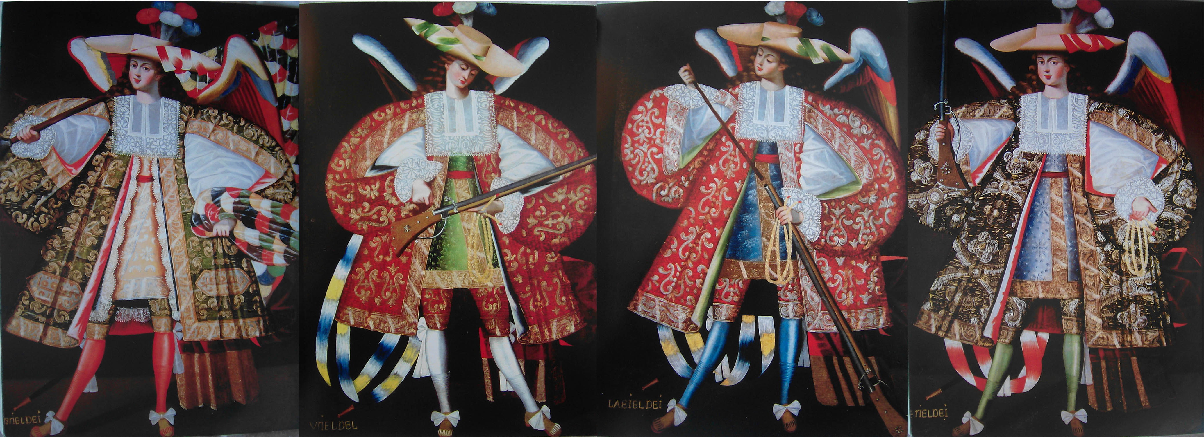
En la plaza hay un inmenso tobogán de tres jorobas; un astroso montón de bultos, trapos y bolsas del que emerge una prehistórica mendiga a calentarse al sol; un mural torpe y colorido –ante un hirviente y solidario perol, mujeres bien arropadas ofrecen sopa a apuestos ferrocarrileros– que no se ruboriza de su función social. Dorado en el flanco poniente de la plaza queda el gran galerón del Coliseo Municipal. Las bardas ostentan caducas proclamas oficiales –“Por la refundación de Bolivia, sí a la nueva constitución”– y retratos de Evo. Bajo estos últimos, pintas de oposición ponen en duda su hombría.
Poco a poco la ciudad de Uyuni se va desperezando. Algunas muchachitas, de minifalda a pesar del fresco, cruzan la plaza en diagonal. Rumbo a la secundaria. Una se acerca. Envolviéndola como un perfume, una matinal nube de cumbia la precede y, sin prisa, pasa con ella de largo. Lleva un radiecito encendido en el bolsillo. La mochila en bandolera bota tímidamente en ritmo con los pasos de sus piernas cobrizas.
Carlos silba y me hace señales desde el techo del vehículo. La patrona ya está lista para ir a desayunar. Sus maletas de cámaras, lentes, filtros, exposímetros aguardan en la acera. Acudo a ayudarlos a cargar el material.

• • •

En las calles de Uyuni, hordas de perros variopintos retozan, ladran, se ayuntan, sestean a la sombra de las bardas, hurgan en los montones de basura, se disputan a gruñidos unos pellejos. Trotan, felices y mugrientos, en total libertad. Viven –se los deja vivir– con canina plenitud. Para ellos al menos, la desangelada Uyuni es el paraíso terrenal.
Sentada al aire libre, Scarlett me describe el programa del día, me muestra un par de bocetos. Bebemos café con leche y establecemos una lista de materiales, que Carlos recoge y parte a buscar.
Desde la mesa del desayuno arrojo al gran perro tuerto que dormita una costra de pan. Craso error. De inmediato nos rodea, para horror de las turistas inglesas que se untan bronceador en la mesa de junto, una expectante jauría, canina corte de los milagros.
Carlos retorna de las ferreterías con herramienta, materiales, con víveres y agua. Llenamos los tanques de gasolina y partimos nuevamente al salar.

• • •

Estamos en mitad de la nada.
Con el visor de campo en la mano izquierda, Scarlett se pasea evaluando en silencio diversos parámetros: las siluetas lejanas de los montes –Isla Pescado; el volcán Tunupa en óxidos y grises, imponente aun en su lejanía–, la claridad de líneas en la retícula de sal, el ángulo de incidencia de la luz matutina. Se asoma al visor y, a partir de un elemento ausente que solo existe en su espíritu, establece la composición. Dispone enseguida, y nos lo indica con largas zancadas y virajes en ángulo recto, dónde habremos de trabajar.


Quiere pintar una suerte de alfombra colorida en la blancura del salar, cada polígono en un color diferente.
Soy yo quien se ocupa del trazado. Sugiero un rectángulo en sección áurea, que Scarlett descarta como mera frivolidad. Cinco por siete metros, y con eso basta, dice, e indica la orientación. Así que armado de una larga piola de plástico, lápiz, martillo, clavos para calamina, y vaporosas nociones de agrimensura egipcia –la cuerda de trece nudos–, trazo el gran paralelogramo que habrá de servir de límite al color.
Las latas de pintura llegaron de madrugada, enviadas por Gastón desde La Paz. Fuimos a buscarlas a la estación de autobús. Pintura blanca, a base de agua, a la que Scarlett va agregando colorantes líquidos –violeta, bermellón, azafrán, ocre– en busca del tono adecuado. Con un palo de escoba, bate con vigor la pintura en el balde en el sentido de las manecillas del reloj. Reparo en ello porque yo suelo batir pintura en el sentido inverso... ¿Será, me pregunto, porque Scarlett es zurda? ¿O porque estamos al sur del Ecuador?
Carlos nos propone una pausa antes de comenzar a pintar. Ha preparado emparedados de sardinas con locoto y paltita. La sal la rascamos directamente del suelo, con una navaja, y la espolvoreamos sobre la palta, sobre las frescas rodajas de tomate.
De pronto, en el horizonte, un punto negro. Imposible a un principio saber si es hombre o vehículo, si se aleja o acerca.
Resulta ser una pequeña pick-up  destartalada que a toda velocidad, en un giro abierto, circunda como un ave de presa la parcela con nuestro trazado. Carlos y Scarlett se miran con desazón. Bruscamente el piloto tuerce el timón y se acerca a nosotros en línea recta, dispuesto a arrollarnos. Se detiene de un frenazo a escasos cinco metros.
Seguro de sí, un hombre enjuto, correoso, moreno en extremo se baja del auto sin cerrar la portezuela y su mirada recorre con recelo nuestros inocentes trazos y cuerdas, el trípode, las latas de pintura.
–¿De qué comisión vienen? –nos grazna sin quitarse los anteojos oscuros.
Lleva una gorra, una sudadera que alguna vez fue gris, guantes de carnaza, la bragueta abierta. (Más tarde debatiré con Carlos si graznó “comisión” o “concesión”.)
–De ninguna, estamos tomando unas fotos...
–Qué, ¿son geólogos o ingenieros, o qué? –pregunta hosco, autoritario.
Me embrollo un poco al explicar, con demasiado detalle, que Scarlett es fotógrafa, que es holandesa, que estamos preparando el terreno para sacar una fotografía, que los tintes serán solubles en agua...
Poco parece interesarle. Sordo, se empecina:
–¿Vienen por el litio?
Avizoro de pronto una posible salida: Gastón tiene décadas de merodear por el salar, conoce gente.
–Somos artistas, amigos de Gastón Ugalde.
El rostro inexpresivo, de justiciera deidad andina, se suaviza de inmediato: él también es amigo de Gastón. Es vigilante y ha estado patrullando, haciendo decomisos. Nos conduce a la caja de su camioneta: largos troncos huecos de madera de cardón. Clara, agujerada.
–Esos palos tienen como cien años. Los han estado cortando allá en las islas –señala vagamente su mano enguantada– y no se los puede cortar. Solo se pueden recoger los ya caídos.
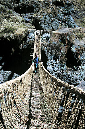
Fibrosa y resistente, el alma del cardón –el cactus gigante cuya silueta espinosa, en las islas del salar, se delinea por docenas contra el cielo– es la única fuente de madera en la región. Refuerza con dinteles cacarizos los vanos de las puertas de adobe, da forma a algunos muebles toscos, sostiene, en delgadas vigas, las frágiles techumbres. El dilema: el crecimiento del cactus es lentísimo. Los testarudos órganos monumentales viven –acotan sin falta las guías de turismo, siempre preocupadas por vendernos lo excepcional– centenares de años.
Alfredo, que así se llama el vigilante, trabaja por cuenta propia desde hace cuarenta años. De su rostro cuerudo deduzco que hoy pasa de sesenta, aunque acaso no –el Altiplano es inclemente–. Entonces no había movilidades. Pero él se puso a explorar y a vigilar el salar. Entraba en bicicleta.
–Esto no era nada. A nadie se le figuraba que esto es algo que hay que proteger, que es una joya de la naturaleza. A nadie le importaba nada el salar. Nadie venía. Se reían de que viniera yo envuelto en ponchos a dormir en las cuevas, con las vizcachitas. Esos carros como el suyo que entran ahora, no había...
Sin transición nos envuelve en explicaciones deslavazadas sobre los lugares sagrados de los ancestros, alineamientos de ruinas alejándose en intervalos regulares desde el Tunupa hasta el volcán Licancabur. Y tan de improviso como llegara, se mete a su camioneta y azota la portezuela.
–Ahí me saludan al Gastón –grita ya maniobrando–, de parte de Alfredo, “el Loco” del salar.
Se va. Nos deja jugar, el Loco. El guardián. Constató a su manera que éramos inofensivos.
Comenzamos a pintar.
Trabajamos hincados, con brochas y rodillos. Scarlett ha dispuesto el esquema de color para toda la retícula. Carlos avanza con velocidad, cubriendo con el rodillo las grandes áreas centrales de cada polígono. Scarlett y yo terminamos el trabajo a la brocha, lentamente, pintando los bordes con un respeto estricto de las crestas de sal.

Estamos en mitad de la nada: blancura y silencio 360o a la redonda. Hasta el horizonte, no hay otra cosa que una enceguecedora costra de sal, una planicie calcinada. Nada en que reposar la vista, nada que permita estimar distancias.
Al cielo del salar, por lo ordinario despejado –salvo en el horizonte–, lo cubre hoy por ventura una baja capa de nubes. Lo cual hace el trabajo llevadero. Coloreamos uniformemente los azarosos polígonos según las indicaciones cromáticas de Scarlett.

Pintamos.
Durante varias horas.
Al avanzar la tarde comienza a arreciar el viento. Desprende de las brochas y rodillos babas coloridas, hilos de pintura que ensucian zonas ya terminadas. Scarlett, para no arruinar con pringues amarillos su pantalón de mezclilla, lo ha vuelto sobre sí mismo como un guante.
Mi brocha está embadurnada de bermellón hasta la empuñadura. La inflexible costra de sal me tortura las rótulas aun cuando me arrodillo sobre una bola de trapo. Una voz silenciosa me repite que esto de colorear a brochazos el desierto es, a todas luces, un acto absurdo. Esfuerzos inútiles: las posibilidades de que algún despistado esteta pase por aquí son remotísimas. Tan cansino monólogo ocurre a ras del suelo.
Al fin, el último polígono se cubre de amarillo yema y, adoloridos, enderezamos la espalda. Despejamos brochas y latas. Trepamos al techo de la camioneta para ganar en altura un par de metros.
Y hela ahí, la alfombra mágica.
Majestuosa.
Si nos ceñimos a la etimología, acabamos de ejecutar una pintura rupestre (del latín rupes, roca).
Arte rupestre en paint by numbers.
La primera impresión del hipotético viajero que por azar tropezara con ella en la inmensidad del salar –hecho, cierto es, poco probable– sería que solo volando por los aires pudo la alfombra llegar allí.
Pero dejando de lado los cuentos orientales, algo resulta indubitable. El desierto, mirado desde el techo de la camioneta no es ya un páramo indiferente: converge ahora hacia el rectángulo colorido. Me viene a la memoria aquel célebre poema de Wallace Stevens en que el poeta, con un acto simple y modesto –colocar un frasco de vidrio transparente sobre un montículo natural– disloca de inmediato y radicalmente toda percepción del entorno. Transforma el mundo natural en paisaje:
I placed a jar in Tennessee,
And round it was, upon a hill.
It made the slovenly wilderness
Surround that hill.

The wilderness rose up to it,
And sprawled around, no longer wild.
The jar was round upon the ground
And tall and of a port in air.

It took dominion every where.
The jar was gray and bare.
It did not give of bird or bush,
Like nothing else in Tennessee.
(Wallace Stevens, “Anecdote of the jar”, 1919)
La alfombra de Scarlett logra trastocar el desierto de manera análoga. El preciso rectángulo –paralelas y ángulos rectos– impone geometría humana, civilizadora, a un universo mineral de gran regularidad irregular que pretende engatusarnos con una sola e ilusoria línea recta: el inalcanzable horizonte.
Hemos perdido la carrera contra el día. Es demasiado tarde para hacer las fotos. El cielo es un manto gris, uniforme y sucio sobre la blancura de la planicie. La luz, pusilánime. Habrá que retornar al amanecer en busca de un poco de carácter. Decidimos para ello no volver al lejano Hotel Inti, en Uyuni, e ir a pernoctar en alguno de los encalados caseríos –Jirira, Chantani, Tahua– regados al pie del volcán.
Antes de partir, Carlos y yo hacemos un par de viajes en camioneta hasta la Isla Pescado, donde recogemos rocas con que erigir el mojón de inestable equilibrio que –cruzamos los dedos– mañana en la mañana nos permitirá volver...

• • •

Calcar.
Calcar la alfombra directamente del piso del desierto para hacer fabricar una alfombra real... Una alfombra ¡en lana de alpaca! que reproduzca el dibujo; que niegue con su textura la dureza de la costra de sal; que reinterprete y transforme el gesto cromático dejado en el suelo; que permita enrollar y transportar un trozo de desierto...
Tal es la secuencia de ideas que el insomnio ha desgranado en la mente de Scarlett.
Se compra de mañana popelina blanca por metro en una minúscula mercería del mercado Antofagasta con la intención de cortar el rollo en bandas y coser una gran manta a las dimensiones requeridas para el patrón exacto de la alfombra futura.
Scarlett, al cortarse el cabello en un salón de belleza de Uyuni, entabla plática con una mujer que la procura para practicar su inglés. Se entienden, conversan, y esta pronto se ofrece para coser la tela. Puede tenerla lista, dice, dos días más tarde.
Transcurre el plazo. Griselda, maestra de inglés y costurera a sus horas, nos ha cosido lado a lado cuatro franjas de popelina de siete metros de largo por uno treinta de ancho. “¡Uy!, resultó más trabajoso”, cuenta Griselda al teléfono, “de lo que pensaba”. Las bandas de tela, de tan largas, eran pesadísimas y resbalaban en un montón informe al lado de la máquina, trabándola a menudo. Con un solo pase las costuras no iban a aguantar, así que las hizo reforzadas. ¡Y Scarlett que había previsto pespuntarlas a mano, con hilo y aguja de su costurero de viaje, bajo el desganado neón de su cuarto de hotel!

Ya caída la noche, acompaño a Scarlett por las calles de Uyuni a buscar la tela. Un dejo de fritura inunda el aire. Es noche de mercado.
El marido de Griselda es militar en el denodado y aguerrido –tal es el lema– Regimiento Loa, que antaño peleara en la traumática Guerra del Pacífico. Tienen una casita en la zona residencial de los cuarteles, al poniente de Uyuni. Debe uno identificarse al pasar la valla de vigilancia.
Griselda nos pone entre brazos, por encima de la verja, un gran fardo blanco y resbaloso que insiste en desparramarse de un lado y otro de la reja. No pudo doblarla sola, se excusa, así que doblamos la manta en la oscuridad de una calle sin alumbrado. Cada quien tira de una esquina –su hija de siete años nos ayuda– tratando en vano de impedir que la manta arrastre sobre los polvosos adoquines. Es verdad: es inmensa. Desde lo alto de la torreta de vigilancia dos centinelas observan. No pueden no pensar en una enorme bandera de la paz, que para la garra y el denuedo del soldado boliviano será símbolo ambiguo.
Algunos billetes doblados cambian de mano. Griselda nos despide desde atrás de la verja. La niña pregunta para qué vamos a usar un mantel tan grande. Vamos a calcar, le explico, un pedazo de desierto. La explicación la satisface. Acepta, sin más, su misterio.
El cabo de guardia se apoya sobre el contrapeso. La barrera se levanta y nos deja pasar. Partimos con el escurridizo bulto de popelina a cuestas.

• • •

Nuevamente en el salar –es de mañana– tendemos y tratamos de tensar la gran manta blanca sobre la alfombra de colores. El bermellón se adivina, por transparencia. A cuatro patas, Carlos, Scarlett, yo mismo, vamos siguiendo a tiento con marcadores indelebles los bordes de los polígonos de sal. Calcamos con aplicación el desierto.
Volví de mi rápida excursión a Tupiza con los mapas más precisos que el Instituto Geográfico Militar dispone del salar de Uyuni. Los más detallados son a una escala de 1:50,000. A tal escala, cada cuadrado de 2 cm en el plano representa un kilómetro cuadrado de terreno. El mapa militar No. 61321 que describe 500 km2 de salar es, sin embargo, un mapa vano. Su rigurosa cuadrícula está total y absolutamente vacía: en el salar de Uyuni no hay nada. Ergo, nada se puede señalar...
En una turbadora parábola intitulada “Del rigor en la ciencia”, Borges postula un remoto imperio cuyo acucioso Colegio de Cartógrafos levantara un mapa al tamaño del imperio mismo y coincidente en todo punto con este.[1]
La tarde declina.
Cuadrilla de enfebrecidos topógrafos bajo la batuta de Scarlett, calcamos directamente del territorio un mapa en popelina. La escala es uno a uno. Sobre la tela blanca, cruzada de líneas que recuerdan el dibujo en los flancos de la jirafa, aparece el mapa de la pequeña parcela del desierto que coincide puntualmente con ella. Tan vano a su manera como el de los cartógrafos militares, es, por el momento, el mapa más preciso que existe.
Lo doblamos. A tres, nos viene en falta un par de manos. Lo metemos a un costal. Ya lo leerán e interpretarán los tejedores de alfombras, sin riesgo de perderse en el desierto.

• • •

Cortaúñas y candados, detergentes, sartenes, eléctrica lencería, tinajas de plástico, plantas medicinales. Dos o tres veces por semana, en bulliciosas hileras paralelas, se alinean por la calle central de Uyuni –la avenida Potosí– los toldos y tenderetes de un mercado. Películas piratas, quesos frescos envueltos en hojas, cobijas sintéticas con soberbios tigres o enternecedores cachorritos, escobas, jeans, emparedados de pollo y chancho, controles remotos y piedras de afilar se disputan la atención del paseante.
“Aquí todo es caro”, protesta Carlos enardecido tras pagar en tres bolivianos la bolsita de champú que en las aceras de La Paz cuesta, si acaso, uno. Porque hasta el remoto Uyuni las cosas –guantes de hule, galleta surtida, flores de plástico, coca del Chapare– hay que hacerlas llegar. Y eso se paga.
Caminamos, a la zaga de Scarlett esquivando gente, rodeados por los sonidos rotos de las transacciones, por las músicas distorsionadas en los altavoces. A izquierda y derecha hay sandías venidas de Los Yungas, siete variedades de papa, electrodomésticos descaradamente chinos. “Bolivia entera es un mercado” es una frase que uno escucha a menudo. Y es verdad que en las calles se consigue de todo: un setenta por ciento de la boliviana es economía informal.
Tropezamos casi con un carrito de especias. Una chola rolliza con una guagua dormida a cuestas las vende a granel. Hay cucharones sepultos hasta la mitad en bolsas de ancha boca arremangada. Los polvos coloridos, materias todas de la tierra, tienen más o menos los mismos tonos que eligiera Scarlett para pintar su parcela de desierto. La chola –un destello de oro en su sonrisa– nos vende 250 gramos de pimentón molido, otro tanto de ají amarillo y de comino en polvo.

Al día siguiente, en el salar, una prueba con un puñado de ají se revela concluyente: ¡son esos y no otros los materiales que deben intervenir en la pieza! Nada de pintura de agua o de aceite, no, sino temible ají, fragante canela molida, llamativo pimentón, cosquillosa pimienta negra, espolvoreados todos sobre la resplandeciente costra de sal... Una manera de devolver a la tierra lo que se ha sacado de ella. Una ofrendaUna challa  en polvo. Y una vez fijado el instante en la placa fotográfica, el implacable viento del oeste, las lluvias (que este año tardan en llegar), irán borrando el tapiz de especias, deshilachándolo, esfuminándolo, condimentando las lejanas lindes del salar. La intuición en el mercado de Uyuni aporta a la pieza –de inmediato resulta claro– la pizca de sentido que parecía faltar.
Pero ya no estaré allí para mirarlo. Debo retornar hacia la insulsa Europa.
Carlos guiará a Scarlett por el hormiguero del mercado de El Alto y en cosa de una semana estarán de vuelta en Uyuni –nueve horas de brincos y de polvo, algún cambio de llanta– con la camioneta cargada de apretados, aromáticos bultos. ~


[1] “En aquel Imperio, el Arte de la Cartografía logró tal Perfección que el Mapa de una sola Provincia ocupaba toda una Ciudad, y el Mapa del Imperio, toda una Provincia. Con el tiempo, estos Mapas Desmesurados no satisficieron y los Colegios de Cartógrafos levantaron un Mapa del Imperio, que tenía el Tamaño del Imperio y coincidía puntualmente con él. Menos Adictas al Estudio de la Cartografía, las Generaciones Siguientes entendieron que ese dilatado Mapa era Inútil y no sin Impiedad lo entregaron a las Inclemencias del Sol y los Inviernos. En los Desiertos del Oeste perduran despedazadas Ruinas del Mapa, habitadas por Animales y por Mendigos; en todo el País no hay otra reliquia de las Disciplinas Geográficas”, Suárez Miranda, Viajes de varones prudentes, libro cuarto, cap. xlv, Lérida, 1658 (“Del rigor en la ciencia”, Jorge Luis Borges).


1876: Descripción de los puertos de Bolivia (I)

The Coasts of Chile, Bolivia, and Peru Compiled by The United States Hidrographic Office (1876)

ADVERTISEMENT.
The basis of these directions and the description of the coasts of Chile, Bolivia, and Perú have been the works of Capt. F. Chardonneau, of the French navy, and of Capt. Aurelio García y García, of the Peruvian navy, Les Instructions nautiques sur les Côtes du Chile et de la Bolivie and El Derrotero de la Costa del Perú. In the compilation, extracts have been made from the Surveys on the Coast of Chile, by Captains Simpson and Gormaz, of the Chilean navy; from Notices of the Examination of the Coast of Chile, now in progress, under the direction of Lientenant Uribe, Chilean navy; from El Anuario Hydrografico de Chile; the British Admiralty South America Pilot; the American Cyclopaedia, and the remark books of officers of the U. S. Navy, together with the most recent British Admiralty, French, and Chilean charts, notices, &C.

R. H. W.
U. S. HIDROGRAPHIC OFFICE,
Washington D. C.


(NOTE. All courses and bearings are true, unless otherwise stated/ The distances are expressed in nautical miles./ The longitudes are from the meridian of Greenwich.)


[...]

THE COAST OF CHILE, FROM THE GULF OF PENAS TO THE BOUNDARY OF BOLIVIA, WITH THE OFF-LYING ISLANDS.
 
CHAPTER I.
GENERAL DESCRIPTION.

The republic of Chile is boarded on the north by Bolivia ; the 24th parallel of south latitude, which is seven miles to the southward of cape Jara, is the dividing line between these two states from the Pacific coast to the Andes. The tract of land comprised between the 23d and 24th parallels is in fact considered neutral territory*, The boundary line then follows the crest of the Andes to the Rio Negro, and thence the course of this river to the Atlantic ocean ; these two natural boundaries separate this country from the Argentine Republic.

Chile claims the whole of Patagonia, though the Argentine Republic contests a portion of it, and by establishing a settlement at Punta Arenas in the strait of Magellan, Chile** pretended to secure the entire possession, and a protest filed by the consul-general of Chile at London in 1872 clearly established this claim.

These directions will treat only of that portion of the Chilian coast comprised between cape Tres-Montes and the river Loa.

In 1872 the population of Chile was about two millions.

The capital is Santiago.

The provinces on the coast, commencing at the north, are as follows : Atacama, Coquimbo, Aconcagua, Valparaiso, Maule and Colchagua, Concepcion, Valdivia, Llanquihue, Chiloé, Magallanes.

*This tract, which comprises the desert of Atacama, was considered without value. Since the discoveries of mines of precious metals and of copper, numerous difficulties have arisen between these two conntries, broaght about by the explorers of this territory.
** According to Malina, the word Chile or Tchili is derived from the cry of a thrush which is very common in this country. 

The maritime governors of these provinces reside as follows : of Atacama, at Caldera ; there are subdelegates at Sarco, Peña Blanca, Huasco, Carrizel-Bajo, Chañaral, Pan de Azúcar, Taltal, and Paposo; of Coquimbo, at Coquimbo; subdelegates at Guyacan, Tongoy, and Totoralillo; of Aconcagua, at Papudo; subdelegates at los Vilos and Pichidanqui; of Valparaiso, at Valparaiso; subdelegate at San Antonio ; of Maule and Colchagna, at Constitucion ; subdelegates at Llico, and Buchupureo, and at Curanipe ; of Conception, at Talcahuano; subdelegates at Tomé, Coronel, Lota, and Lebu ; of Valdivia, at Corral ; a subdelegateat Queule; of Llanquihue, the maritime governor resides at Puerto Montt,*a subdelegate at Calbuco; of Chiloé, at Ancud, a subdelegate at Melinkat (Guaiteca Grande); of Magallanes, the governor resides at Punta Arenas.

Chile to the Rio Maule was part of the empire of the Incas. Diego Almagro, the lieutenant of Pizarro, first led the Spaniards to this country in 1535. It was conquered by Pedro de Valdivia during the years 1541 to 1554, he having laid the foundation of Santiago in December, 1540; of Séréna in 1543, of Valparaiso and Penco (old Concepcion) in 1550, and of Imperial and Valdivia in 1552. He commenced the struggle against the Araucanians, who, after many conflicts, captured him and put him to death in 1559.

For two centuries and a half the history of Chile is full of the events of this struggle. During this period the Araucanians defended their independence, and often with success. All the cities of the southern part of Chile were frequently destroyed by them, notably during the period from 1599 to 1604, and all excepting Imperial were obstinately rebuilt by the Spaniards. They were often forced to treat with the Araucanians and to observe the treaties.

The Spaniards were also several times disturbed in their possession by the English buccaneers. Drake plundered Valparaiso in 1578, Hawkins ravaged Chile in 1594, Narborough in 1668, Sharp in 1680. The Hollanders also plundered the coasts of Concepcion, Valdivia, and Chiloé in 1600, 1615, and 1643. The selfish policy of the Spanish government produced the same effect in Chile as in its other colonies. Profiting by the revolution of 1808, the Chilians made their first efforts toward separation in 1810, but with very little success. General San Martin, of Buenos Ayres, aided by Argentine troops and the remainder of the independent party, defeated the Spaniards at Chacabuco; on the 15th of February, 1817, took possession of Santiago, and by the victory of Maipo, April 5, 1818, assured the independence of Chile, although the war was continued until 1822. Valdivia was held by the Spaniards until 1820, when it was captured by the English Admiral Cochrane, who had formed a Chilian navy, placing himself at its head. Chiloé was finally incorporated in the republic in 1826. The re-public then gave its assistance to all the other Spanish colonies, especially to Perú, in their struggles against the mother country.

After the declaration of independence, Chile, like its sister South American republics, was rent by civil discord until 1830. The radicals, who had Pinto and Freire for their chiefs and generals, battled against the conservatives, who were led by O'Higgins and Prieto. The latter finally triumphed in the battle of Lircay, the 17th of August, 1830, and instituted the conservative progressive form of government which gave to Chile forty years of almost uninterrupted prosperity. The country became settled little by little, and owing to the wisdom of the inhabitants the revolutions were superseded by a peaceful constitution.
President Prieto, who was elected in 1832, and supported by a true statesman, Portales, was reelected in 1836. General Bulnes, also twice president, 1841 to 1851, had a tranquil administration, bat after his term of office was called to suppress a serious insurrection caused by the radicals. He then became the commandant of the troops raised by President Montt, who had succeeded him in 1851, and was reelected in 1856. During his second presidency he had to struggle against a combination formed by the radicals and ultraconservatives. He was successful, and transmitted his office peaceably to Perez in 1861, who continued in office until 1871. Under his administration the most important event was the war against Spain, in which this republic had Perú, Bolivia, and Equador for its allies. The principal incidents of this war were the capture of the Spanish steamer la Covadonga by the Chilian corvette Esmeralda, the blockade and bombardment of Valparaiso in 1865, and the undecided battle of Abtao between two Spanish frigates and the Chilian squadron. Perez transmitted his charge to Errazuriz in 1871.

[...]

The coast of Chile, which is washed by the Pacific, inclines gradually to the eastward from Valdivia to the Loa, which is the eastern point of the west coast of South America. It has numerous indentations, which are protected from the southward by promontories, but open to northward. After leaving the archipelago of Chiloé and Chonos, where many sheltered bights are found, there are only two or three bays on the entire coast to Bolivia which offer the double advantage of protection both from the north and south.
[...]


Durante el siglo XIX parece haber proliferado la elaboración de mapas de Sudamérica con una delimitación más o menos libre de las fronteras entre países. Si embargo, por más arbitrarios que aquellos cartógrafos y sus predecesores hayan sido, todos reconocen una constante: según como sea representada Bolivia (Potosí, La Plata, Audiencia de Los Charcas o Alto Perú) siempre figura con su territorio soberano sobre el Océano Pacífico, el departamento del Litoral.
The New York Publica Library: South America (1876) Davis, F. A. Dutchess County (N.Y.) Maps Kochersperger, H. L. W. Gray and Son (Philadelphia, Pa.)


THE COAST OF BOLIVIA

CHAPTER X.
FROM CAPE JARA TO THE RIVER LOA.

Variation from 12° 30' to 11° 03' easterli, in 1876, increasing annually about 1' 30''.
 
Bolivia borders the Pacific Ocean for about 250 miles, from cape Jara latitude 24° S. to the river Loa, in latitude 21° 28' S.; it is bounded to the NW. and N. by Perú, on the E. by Brazil and Paraguay, and to the SE. and S. by the republic of Chile; its extreme length being about 1,100 miles, with a breadth of 800 miles.
 
The coast of Bolivia is part of the desert of Atacama, which constitutes the province of that name. This province is sparsely populated, containing hardly from 6,000 to 8,000 inhabitants. The coast is generally formed of high sand dunes, leaving but a few feet of beach, which is clean and can be followed at a short distance from the land. Like the coasts of Chile and Perú, it is constantly washed by the southerly swell, and has but few coves or inlets, and those generally bad.
 
DESERT OF ATACAMA
The desert of Atacama extends from Copiapó to the river Loa, and as far as Iquique and 120 miles into the interior, to the spurs of the Cordillera of the Andes. It is barren and uninhabitable; fresh water is unknown, and it never rains; the easterly and southeasterly winds being arrested by the Andes, their snowy peaks condense all the humidity which comes across the plains of the Argentine Republic and Paraguay; and the waters which come down from the Andes are lost in the sands of the desert, which renders them salt.
 
The desert of Atacama is covered by black shifting sands, or dark brown sand varied at times by gravel and stones which are so sharp that the hunters of the guanaco have to shoe their dogs. It is probable that Bolivia was inundated to the foot of the Andes during prehistoric time, and that this part was raised with all this coast of the continent; this is proved by the numerous fossil marine shells, caracoles, and large blocks of pure sea-salt, which are found in the ravines of the inomitains; the soil itself is full of salts of lime and soda.
 
The only products which were for a long time taken from these western slopes of the Andes were nitrate of soda and guano; a few years ago, however, some very rich silverores were found in the midst of the desert at Caracoles, which is 951 feet above the sea. This place was connected with Mexillones by railroad. The port of Antofagasta was created, and the mines in this desolate part of the earth immediately became a source of strife between Perú, Chile, and Bolivia.
 
THE CLIMATE
The climate of the one hundred and fifty miles of coast of Bolivia does not need any special description after the remarks made on that of the northern provinces of Chile. Calms are very frequent, and the trade-winds take the place of local breezes.
 
The prevailing winds are from SSE. to SSW., modified by the land and sea breeze; the wind is generally light; during the night it is usually calm. There is a thick damp fog from about 9 p. m. to 10 a. m., especially during the months of March, April, and May. There is little movement of the barometer, and no gales of wind; the swell is often heavy and without warning.
 
The population of Bolivia is stated at about 1,742,352. The capital is Sucre, the ancient Chuquisaca, also called Charcas and la Plata; it has about 24,000 inhabitants.
 
DESCRIPTION
The republic of Bolivia has for a long time existed on its mines of precious metals; those of Potosi are still celebrated, but they yield less and less. The exportation is much inferior to the importation, and the country becomes poorer and poorer. The civil discords are not calculated to improve this state of affairs. The exportation, which is in the hands of foreigners, consists of guano, niter, copper, and mineral ores. The United States and Europe supply all the necessaries of life.
 
Formerly Peruvian bark was a source of wealth to Bolivia, but it has been gathered so recklessly and the forests are so impoverished that it has almost ceased to be remunerative.

CAPE JARA
Cape Jara is a steep rock, rounded on its northern side, 22 miles from el Cobre. The coast between them bas the same aspect and direction as that to the southward of the latter. In the northern part of the cape is a small but safe core, which can be used by small vessels. Vessels which are hunting the seal frequent it, and they leave their boats here to hunt in the vicinity. They are provided with fresh water, and for fuel they use the wrack which grows in abundance on the coast. No provisions are to be found for a considerable distance on either side of the point. Mount Jara, 4 miles to the eastward of the cape, is 3,986 feet high.
MORENO BAY 
Moreno bay commences 4 miles N. 19° E. of cape Jara, and extends to point Las Tetas, the SW. extremity of mount Moreno. The coast between point Jara and the commencement of Moreno bay is high and rocky, and has no remarkable feature other than the Black rock, which lies a little to seaward.
 
Moreno bay has several anchorages; it commences with Paja Brava, an inhospitable sand-coast bordered by high hills, in the center of which is the port of Antofagasta, about 13 miles from Black rock.
 
PORT OF ANTOFAGASTA
Port Antofagasta is the harbor of export for the nitrate of soda, which is found nine miles from the town, back of the first line of hills, as also of the silver-ores coming from the mines of Caracoles, 114 miles distant, in the desert of Atacama.

The anchorage is to the northward of a bank of stones  which extends to seaward for 1/3 mile. The depth is from 14 to 17 1/2 fathoms; bottom stiff blue mud, covered by sand, coral, and shell. It is 2/3 of a mile from the moles of the port.

It is necessary to anchor far enough off the bank to have saflicient room to swing with from 45 to 60 fathoms of chain when the fresh wind from SSE. changes to N. Two anchors are always necessary, and in ordinary weather an anchor astern, with the head SSW., to stem the constant swell.

The bank of stones is always washed by the swell. Oft its NW. extremity, and a short distance from it, is a rock which is only visible with a moderate sea. It is thought that the Steamer Paita touched on it, and it was necessary to beach her near the mole in the inner harbor. The bank is steep to, and has about 3 3/4 fathoms alongside.

To the eastward of this bank is a cove with 3 fathoms of water, with a channel into it 240 yards wide, full of rocks, and from 3 3/4 to 5 fathoms deep. Two rocks, with 9 to 11 feet of water over them, situated in the line of the northern mole, render it dangerous ; the channel must be used only during a calm, and never by large vessels ; vessels not drawing more than 13 feet are perfectly secure, and sheltered from the sea by the bank, and can load very easily. At the bottom of the port are two moles, parallel to each other and projecting to the NW. When the weather is at all boisterous the sea not only breaks heavily on the bank, but the entrance of the inner harbor is closed by a bar. This takes place at the change of the moon, and especially during the season of north winds, from April to July; then not even lighters can lie alongside the mole. With the exception of these four months, the wind blows from the south during the day, with the fresh land-breezse at night.
 
Between two hills to the southward of the town is a watering-place, with brackish water, wich is used for the animals; people drinks condensed sea-water.
 
Vessels bound to Antofagasta from the southward should make Jara head, then steer for the bay of the bay of Moreno, keeping 4 or 5 miles from the land. When Antofagasta bears NE. by E., a large withe anchor will be seen painted on a ridge back of the town. Continue along the land until the anchor bears E. 13° S., when steer for the anchor, and keep the lead going until the 16 fathoms, wich is the anchorage. Is is best to select a berth outside of other vessels.
 
When coming from the northward the anchor will be seen as soon as point Las Tetas is doubled; lower, and nearer the beach, the powder house also will be seen, wich is a hut covered with zinc and located above the principal street.
 
It is advisable not to attempt to enter the anchorage at the night, as the lights of the houses mislead, and there is a great danger of grounding on the bank of stones.
 
Antofagasta is a uncomfortable anchorage, owing to the constant swell. It is not sheltered, but neither wind nor swell has been experienced of sufficient strenght to cause anxiety for the safety of vessels at anchor. No supplies are to be obtained, owing to the aridity of the country.
 
RAILROAD
A line of railroad from Antofagasta to Salar del Carmen was completed in 1874.
 
CHIMBA OR BOLFIN BAY
Chimba bay [* Chimba is the name given by the natives.], 3 1/2 miles N. of Antofagasta, is to the eastward of an islet 436 yards long, running to the NW., called Oesté, Huanosa, or Bolfin; a short distance to the northward of it are some rocks. the cove is very small, but it is protected from the prevailing winds. The anchorage is 200 yards east of the N. point to the island in 7 or 8 fathoms, bottom fine sand; there are hardly more than 200 yards to swing on every side, except to the NW. The island is tolerably high, and has on it some guano, wich was at one time exported, but is has been abandoned; there are also several depots of salt. The channel between the island and the mainlandis only accesible by boats. There is no fresh water.
 
From Chimba bay to the coast trends NW., then south, forming the large bay of Jorge, bounded to the westward by mount Moreno.
 
MOUNT MORENO
Mount Moreno was formerly called Jorge. It is teh more prominent point on this part of the coast. Its summit is 4,160 feet above the level of the sea, and slopes to the south; buth to the northward it ends abruptly in barren plains. It is of a brown color, without the least sign of vegetation; its western slope is cut by a deep ravine. The SW. point of the peninsula of Moreno descends gradually from the summit of the mountain and ends in two hillocks, to wich the Spaniards gave the name of Las Tetas. This point es 22 miles N. 15° W. from cape Jara.
 
CONSTITUCION ANCHORAGE
Constitucion is a small but convenient anchorage formed by the continent on the one side and by the island Forsyth on the other. It is situated immediately under mount Moreno, about 5 miles N. of point Las Tetas. A vessel can be hauled up and careened here without beinn exposed to the heavy swell which is felt in most of the ports of this coast; landing is easy. The best anchorage is to seaward of a sandspit at the NE. point of the island, in 6 fathoms, muddy bottom. It is best to moor securely, as the sea-breeze sometimes sets in very fresh. Farther out the holding-ground is bad, and on entering, the island or weather side should not be hugged too closely; as there are numerous sunken rocks, but few of wich are indicated by sea-weed. It would be
ttom. It is best to moor securely, as the sea-breeze some- times sets in very fresh. Farther out the holding-ground is bad, and on entering, the island or weather side should not be hugged too closely, as there are numerous sunken rocks, but few of which are indicated bv sea- weed. It would be best to keep in midchannel, provided the wind admits of reaching the anchorage. There is neither wood nor water in the vicinity.
ESMERLADA ROCK
About 4 miles N. of Forsyth island, opposite a mountain 1,630 feet high, is a bank of islets and rocks, called Lagartos. It is 1 1/2 miles long, trends NNW. and SSE., and is close to the shore. About 1 1/3 miles from these islets is Esmeralda rock, covered by 9 feet water. On it there is always a heavy swell, if not breakers, at the syzygies. It was discovered by a Chilian corvette of that name. It lies under the following bearings:
Lagartos bank ........... N. 83° E.
Mount jNIcxillones .......... N. 25° E.
Mount Moreno ........... S. 380E.
The depth 30 yards from Esmeralda rock is 7 1/2 fathoms, and in the channel between Esmeralda rock and Lagartos islets there are from 8 to 12 fathoms of water.
 
POINT ANGAMOS, OR LEADING BLUFF
The chain of plateau which commences at mount Moreno is terminated 12 miles N. 2° E. of Constitucion harbor by a rugged hill called mount Jorgino. On the N. coast of this promontory is the bay of Herradura de Mexillones, a narrow branch of the sea, which makes in to the eastward but affords no shelter.
 
About 9 miles north of mount Jorgino is point Low, surrounded by sunken rocks, and 5 miles to the NE. is point Angamos, or Leading bluff, a very remarkable promontory, which, with mount Mexillones a few miles to the southward, is the best landmark for all the ports of the vicinity, but especially for Cobija. The bluflf of point Angamos is about 1,000 feet high ; it faces to the N., and as it is entirely covered with guano it resembles a cliff of chalk.
 
ABTAO ROCK
About 1/2 mile NW. of this bluflf lies an island which is connected with the point by a reef. No dangers were known outside of it until the steamer Abtao reported several rocks in the vicinity of the large island. The position of the one farthest to seaward, called Abtao, given by Captain Montt, of the Chilian navy, is 1,620 yards from the nearest land, and on the following bearings:
Point Angamos .......... S. 55° 51' E.
Mount Mexillones .......... S. 06° 51' E.
Point Baja, (low) ........... S. 34° 09' E.
Little White island, (distant 700 yards) ........... S. 10° 21' E.
 
There are 2 1/2 fathoms of water over it at low water. To clear it give it a berth of 1 mile, and do not change the coarse until point Angamos bears a little to the southward of SE. by E.
There are two other sunken rocks, one 350 yards to the southward of Abtao rock, covered by 5 fathoms of water, and the other SSB. J E., distant 415 yards, with 6 fathoms of water over it.
Abtao rock is on the line of Little White island and a large white patch which will be seen on the slope west of the Morro, bearing S. by E., and also on the line of the first elevation to the northward of mount Mexillones. The rock is not indicated by sea-
weed or eddies.
 
MOUNT MEXILLONES
Mount Mexillones is 2,630 feet high, resembles the frustum of a cone, and can be distinguished above the surrounding heights. In clear weather it is a better landmark than point Angamos, but the summits of the mountains on the coast of Bolivia are very frequently covered by thick mist, which renders Leading bluff a better mark, as it cannot be mistaken owing to its chalky appearance, it being the end of the peninsula, and the land suddenly receding to the eastward. The small chain which runs from mount Moreno to mount Mexilloues is not connected with the principal chain, and has a form resembling that of a wedge.
In 1862 some important discoveries of guano were made around the base of mount Mexillones, and since 1863 two vessels have carried from it 2,100 tons of guano to Europe. The quality is similar to that of Paquica, the best guano of Bolivia, but it is inferior to the guano of the Chinchas.
 
BAY OF MEXILLONES DE BOLIVIA
The spacious bay of Mexillones de Bolivia opens to the eastward of point Angamos; it is 8 miles wide, and is now much frequented, though there is neither wood nor water. As it borders the great desert of Atacama, its vicinity is perfectly desolate, and it is only the discovery of guano that has given it any importance.
There are two anchorages, both on the W. side of the bay; the one for guano vessels is 3 miles from point Angamos, on a line between two wooden landings, from 200 to 400 yards from the shore, in from 8 to 13 fathoms of water, bottom fine sand ; the other is near the village San Luciano. The anchorage is good in from 6 to 12 fathoms, with the flag-staff bearing S. 9° E., or the lauding S. 18° W., according to the distance of theberth from shore; vessels can, however, anchor in any part of the cove; the Lamothe Piquet was about 3/4 mile distant, in 11 fathoms.
The bay of Mexillones would be a good harbor if it was not for the depth, and the holding-grouud being but tolerable. There are in many places of 20 fathoms 600 yards from the land. Violent gusts from the southward come down from the mountains, causing vessels to drag, and it is said that the northerly swell is sometimes felt.
The village of San Luciano is in the SW. angle of thebay ; although it sprang up rapidly, it is still a miserable settlement of 500 inhabitants.
Fish and shell-fish are abundant. When distilled water is not used, it is brought from mount Moreno, but it is bad. Chile has for a long time claimed this as within her boundary.
A treaty in 1867 left the guano trade to Bolivia, on the condition that one-half of the proceeds were given to Chile; recently the boundary between Chile and Bolivia has been determined as being near Mexillones bay, mount Mexillones being cousidered in Chile. A railroad is proposed from this place to the mines of Caracoles.
 
GUALAGUALA COVE
Gualaguala cove is 12 miles N. 66° E. from point Angamos; in it there is good anchorage in 7 fathoms, bottom sand and broken shells. Vessels here take in copper-ore, which is brought to the mole by a tramway. At the end of the latter is a shute under which vessels can lie securely.
 
BAY OF COBIJA OR PUERTO LA MAR
From Gualaguala the coast runs nearly N, and there is nothing worthy of mention between Mexillones and the bay of Cobija, which is 30 miles N 24° E. from Leading bluff. The harbor is protected from south winds by the small point of Cobija, which projects about 1/2 mile to seaward, and is low and rocky but clean. The anchorage is off the town in 8 to 9 fathoms, E. by N. from the point ; bottom sand and broken shells. Four mail-steamers and four coasting-steamers belonging to the P. S. N. Company, touch here every month, making fast to a mooring-buoy which is in 9 3/4 fathoms 1/2 mile from the landing.
 
LIGTH
A light is hoisted every night on the flag-stafl on the point, visible 3 miles, but it must not be relied on.
 
DESCRIPTION
This port, from which wools and ores are shipped, has been improved during the last few years ; a quay, barracks, and custom-house have been built, and the number of vessels which visit it seem to be increasing. A mole has also been constructed, which renders landing, never very easy, somewhat less difficult; even now during a heavy swell some skill is necessary to take a boat through the narrow channel, formed by the rocks, to the mole. The large water- weeds indicate the isolated rocks. The population is about 2,400, not counting the workmen of the neighboring mines. The towns of Potosi, Chuquisaca, Tupiza, and the other towns in the south of Bolivia get their imported merchandise through this port, and as it is the only port of entry of the republic of Bolivia, vessels wishing to load or discharge in another port must touch here to obtain a license from the custom-house.
The principal articles of export are tin, copper, guano, and ingots of silver.
Good fresh water is scarce, as it never rains. Sometimes a small brook formed of the water condensed by the fog runs in a ravine to the northward of the town ; but it is so small that a pipe of the size of a rifle-barrel is large enough to lead it to the reservoir. Condensed water, of which there is always a supply, is generally used. There are some wells, bat the water is brackish and cannot be kept in barrels. Fresh provisions can always be obtained at moderate prices ; the fruit and vegetables for the inhabitants are brought from Chile and Perú.
The only means of transportation to the interior is by mules ; this prevents extension in the exportation of the ores, wools, and other produce of the country. The desert of Atacama commences on the summit of the chain back of the coast, at an elevation of 3,000 feet.
The desert extends 135 miles to the eastward, and no water is found for 90 miles. The mules cross it in three days. It takes 14 days to go to Potosi, a distance of 540 miles ; but Indians on foot, having relays, bring a message in 10 days.
It is high water, full and change, at Cobija, at 10'' ; the rise, 4.5 feet.
 
DIRECTIONS
On the slope of point Cobija is a white stone, which stands out in relief against the black rocks of the land back of it. Generally a Bolivian flag is hoisted on the signal- mast when a vessel is approaching. There is no danger in entering, as the point is steep-to, and can be passed within 200 yards.
The port, however, is not easily recognized. The hills rise directly back of the coast, forming an nninterrapted chain of from 2,000 to 3,000 feet elevation; at their base there is no mark indicating the position of the town. The white, flat rock would be a good mark, were there not another very similar a few miles to the northward. There is, fortunately, a white church on the slope of the mountain, which is an excellent landmark, which can be seen 20 miles in clear weather. It is best to make the land a few miles to the north or south, and then stand along it until the houses are seen. A sailing-vessel should always make the land to the southward of the port.
On coming from the southward. Leading bluff should be made ; when steer to make the coast about 9 miles south of Cobija, and coast along it until two islands with white sum- mits are seen off False point; they are 1| miles to. the southward of the port. The church will prevent Cobija from being confounded with Gatico.
 
COPPER COVE, OR BAY OF GATICO
Copper cove is a convenient point for loading copper-ore, as vessels can anchor at a short distance from the land. The cove can be entered easily, and is clear of danger to a short distance from the shore. The best anchorage has the following bearings: Point Cobija, open of the extremity of Rocky point, the western of the cove, S. 35° W., and the jetty S. 38° E. The depth is 14 to 18 fathoms, bottom fine black sand. The anchor must not be dropped in less than 14 1/2 fathoms.
The ores are taken in bags, on balsas, to the vessels, which are anchored near the coast; 50 tons can easily be shipped in this way in a day. All vessels wishing to load here must first obtain a permit at Cobija.
 
DIRECTIONS
There are no good marks for recognizing Copper cove; the upper part of the mountains is always covered with mist. The white church of Cobija is, however, a good guide during clear weather. When going from Cobija to Copper cove, it is best to steer N. by E., keeping about 800 yards from the coast, until the jetty is opened, then ronnd Bocky point at about500 yards, and drop the anchor as before directed.
When the church of Cobija has been recognized on com- ing from the northward, and it bears S. 21^ E., steer for it antil the huts on the south side of Copper cove are seen ; then bring the mole and an isolated house to the northward in line, bearing S. 58^ E., which will lead to the anchorage. The hnts and mole cannot be seen until 3 or 4 miles from the land. A heavy swell enters the cove, and during calms, or the light prevailing winds from SW., it is difficult for sailing-vessels to get ont ; they should not attempt it with- out their boats ahead, as they would run a risk of being drifted ashore. Huanillo cove, which is 2^ miles from the rocky and dan- Hnamuo cove. gerous cape of the same name, is 6 miles to the northward of Copper cove. The anchorage is in 15^ fathoms, bottom sand and broken shells. The mining works and furnaces are near the beach, and the metals are taken to the end of the mole by a railway. The former is furnished with a crane, under which vessels can always remain with security. A large condensing apparatus furnishes water to the works and to the people. From Huanillo cove the coast trends nearly N. 7^ E. Be- Panta b anca. tween Cobija and Algodon bay, 28 miles, there are some small bays with little depth, and generally sandy, with rocky points, with mountains from 2,000 to 3,000 feet high back of them. About 24 miles from Cobija is Punta Blanca, behind which, to the northward, is a cove in which vessels some- times load ores. Algodon bay is small, with a good depth of water ; it is Aigodon bay. sheltered from the S. by point Algodon, oft' which there is a white islet. The Beagle anchored here i mile from the land, in 11 fathoms, bottom of rock, covered with sand and broken shells. There are three places in this bay in which ores are loaded : Bella Vista, Tocopilla, and Duendas ; in their vicinity are important mines. Tocopilla, which is in the south angle of the bay, has about 800 inhabitants, and is a place of some importance. The principal mines and furnaces belong to an English company, which has constructel a wharf and tram- 276 COAST OF BOLIVIA. way to facilitate the shippiug of the metal aud the discharge of coal and merchandise. Fresh meat can be obtained at a moderate price. Although there is a spring of good fresh water in the gorge of Mamilla, 7 miles to the northward, condensed water is generally used ; there are large eondens- ers, aud they furnish the vicinity. Four coasting-steamers of P. S, N. Company stop here monthly. The spring at Mamilla is 1^ miles from the beach ; the in- habitants generally bring the water in pouches made of the skins of the seal calf, which contain from 9 to 10 gallons. Duendas is in the northern part of the bay, about 1^ miles north of Tocopilla. According to captain Gales, of the Florence Nightingale, there was a prosperous foundery at this place in 1860, the mines only being 1 or 2 miles dis- tant. A mole was constructed out to a depth of 12 feet at low tide, and, although there is always a heavy swell at full and change of the moon, and occasionally at other times, vessels can generally load or discharge. The Florence Nightingale remained here during the two worst months of the year, and, on the average, she did not lose more than one day in the week on account of the swell. There are two dangerous rocks within the limits of the anchorage of Duendas — Duendas rock, in 15 feet wat sels moor, head and stern, about 200 yards from the rocks. Point Arena is low, sandy, and bordered by rocks ; it is IG miles N. 10^ E. from cape Paqnica, near a remarkable hill ; between these x)oints is a village of fishermen. Ves- sels can anchor under x)oint Arena in 9| fathoms, bottom fine sand. The mouth of the river Loa, which is 12 miles N. 21^ E. from x)oint Arena, forms the dividing line on the coast be- tween Bolivia and Perú ; it is the eastern point of the west coast of South America. The Loa is the principal river on (bis part of the coast } it runs in a deep gorge and loses itself in the sand of the beach ; its water is bad, from run- ning through a bed of saltpeter, as also from the surround- ing copper hills. Bad as it is, the people residing on the banks have no other ; at Chacansi, in the interior, the water is tolerably good. During the summer the river is about 15 feet broad and 1 foot deep, and it runs with considerable strength to within a mile of the sea. A chapel on the north bank, half a mile from the sea, is the only remains of a once populous village. It is visited occasionally from the interior for gnano, which is abundant. Point Arena. Loa River
-----------------------------
TABLE OF CONTENTS. Advertisement I
Notice IV
CHILE.
CHAPTER I.
* Gexbral DESCRiPnoN OP Chile 26
Limita ; territorial divisiona : history ; general appearance of the country
and coasts ; prodncte ; earthquakes ; rising of the soil ; climate ; tides ;
variation; coastwise routes; routes to westward ; steamship lines ; gen-
eral commerce.
CHAPTER II.
Dercription of the coast of Chile from the gulf of PbRas to CniLoi:. . 54
Peninsula of Taytao; Chonos archipelago; Pnllnche or Wickham chan-
nel ; Gnaitecas island ; Melinka ; Moraleda channel ; Ninnalaoa chan-
nel ; estuary of Aysen ; San Rafael channel.
CHAPTER III.
Chilo£ AND its archipelago 85
Ancud or San Carlos; strait of Chacao; gulf of Ancnd; Chauques or
Changues Islands ; Desertores islands ; gulf of Coroovado.
CHAPTER IV.
Coast of the Continent opposite Chtlo£ 122
Ahtao island ; Calhnco island ; gulf of Reloncavi ; Puerto Montt or Meli-
pulli ; estuary of Reloncavi ; estuary of Comau or Leteu.
CHAPTER V.
FromChilo^ to Valdivia 154
Estuary of the Rio Maullin; anchorage of San Pedro; Condor cove; Mi-
lagro cove; port of Valdivia or Corral ; Valdivia.
CHAPTER VI.
From Valdivia to Concbpcion 189
Queule; Tolten; Mocha island; Lehu; Santa Maria island; Lota; Coro-
nel ; Talcahuano ; Concepcion ; Toni^.
CHAPTER VII.
From Concepcion to Coquimbo 2SSt
Constitucion; San Antonio Nuevo; Valparaiso; Quintero; Papudo; Pichi-
danqui : los Vilos ; Tongoy. ??
??VI TABLE OP CONTENTS.
CHAPTER VIII.
From CoQUiMBO TO THE FRONTIER OF BouviA ; capbJara253
Qayaoan; Coqaimbo; Totoratillo; Huasoo; Carrlsal Bajo ; Copiapd ; Cal-
dera ; Pan de Azacar.
CHAPTER IX.
Islands OFF THE coast of Chile 262
Jnan Fernandez ; bay of San Juan Bautista or Camberland ; Mas a Faera ;
San Ambrosio ; San Felix.
BOLIVIA.
CHAPTER X.
Description of the coast of Bolivia from cafe Jarato the ritbr Loa 277
General remarks ; Antofagasta; Mexillones; Cobija.
Perú.
ch;apter XI.
General remarks on Per6 296
Limits; aspect of thecoast and country; prodacts; guano coasts; winds;
calms; fogs; dew; tides; carrents; temperature; earthquakes; routes;
coastwise rentes.
CHAPTER XII.
Description of the coast of PERÚ from the river Loa to cape Nazoa.. . 326
Iqniqne; Guaina Pisagua; Arica; Ilo; Mollendo; Islay; Quilca; San
Jnan; San Nicolas.
CHAPTER XIII.
From CAPE Nazca to the BAY OF Casma 371
Independencia bay; Pisco; Chincba islands; Callao; Ancon; Huacho;
Hnarmey.
CHAPTER XIV.
From THE BAY OF Casma to the river Tumbez 40
Casma ; Samanco ; Guafiape islands ; Salaverry ; Hnancbaco ; Malabrlgo ;
Pacasmayo; Eten; Lobos islands; San Jos^ de Lambayeque; Paita;
Tumbez. ??
??VIEWS. ??
??I. Approaohes to Anna Pink bay 29
Coast firom Rees island to oape Ties Montes
n. Approaches to San Carlos de Anoad 69
Approaches to port Melinka from the north
m. Conoepcion Bay «...
Off Manle riyer entrance 183
IV. Approaches to Piohidanqai bay from the northward
Coqnimbobay
Gnyaoan bay 209
y. Approaches to Caldera bay from the sonth
Copiap6 bay 241
VI. Coast from Plata point to Grande point, including Paposa bay
Anchorage off Antofagista 253
Vn. Cobya bay
Coast fit>m Low point to Tetas point 273
Ym. San Felix and San Ambrosio groap
Jnan Fernandez andMasaFuera 257
IX. Coast of Perti between latitndes 22^ and 19^ S 299
X. Coast ofPertl between latitudes 19° and 17^ S 309
XL Coast of Perti between latitudes 17<3 and 16^ S 321
Xn. Coast of Perd between latitudes 16^ and 1&^ S 327
Xm. Coast of Perd between latitudes 15^ and 14<^ S 331
XIY. Coast of Perd between latitndes 14^ and 12^o 8 339
XV. Coast of Perd between latitudes 12^^ and lU^ 8 345
XVI. Coast of Perd between latitudes ll^o and 10^ S 366
XVII. Coast of Perd between latitudes 10° and 8^0 S 373
XVin. Coast of Perd between latitudes &i and 7^ S 381
XIX. Coast of Perd between latitudes 70 and 5<3 S 393 ????
??
ERRATA.
??
??
Page 6, for " coffee " read " copper."
Page 29, for " Tatayo " read " Taytao."
Page 30, for " Melcher *' read " San Melchor.''
Page 37, for « Tatayo " read " Tay tao."
Page 37, for " Yeuche Mo " read " Ynche Mo."
Page 86, for " Abato" read " Abtao."
Page 88, for " Nahnellinahi " read " Nahuelhaapi."
Page 93, for " Qnniobed " read " Qaincbed."
Page 118, for " Paohnapi " read '' Paebaapi."
Page 170, for " Fort Viel » read " Port Viel."
Page 196, for '* Tapolcama " read *' Topoloama.''
Page 199, for ** Fort San Antonio " read " Port San Antonio.^'
Page 343, for " Salzar" read *' Salazar."
Page 357, for <' Carmotal " read " Camotal.''
Plate X, for " Victor" read " Vitor."
Plate XVI, for " Legarto " read " Lagarto."
??

[continúa]


https://archive.org/stream/coastschileboli00offigoog#page/n305/mode/1up

viernes, 23 de noviembre de 2012

Ingeniería: Un itinerario turístico en la actualidad


PERU and BOLIVIA: CULTURAL ADVENTURE TRAVEL IN THE INCA EMPIRE


"[...] the enigmatic Inka site of Moray, where giant natural sinkholes have been converted by the Inkas into terraced agricultural sites [...]"


HERE'S THE ITINERARY:

DAY 1, Friday, 3/29: Fly US to La Paz, Bolivia (LPB); arriving around 7 AM Saturday. DAY 2, Saturday, 3/30: Morning: Arrive in La Paz, at one of the world's highest airports, over 4050 m (13,300 feet) above sea level. During the transfer from the airport to our hotel we drop about 1500 feet, and get our first views of La Paz, sprawling throughout a valley below the plateau on which we landed, with snow-crowned Illimani towering on the distant skyline. We will proceed directly to the Residencial Rosario, a pleasant 3-star hotel with a good restaurant, to rest, sip some coca tea, and begin to acclimate to the altitude. It is highly advisable to take it easy upon arrival to avoid soroche, altitude sickness. Afternoon: La Paz, population approaching a million, is the de facto capital of Bolivia, which is to say that although the much smaller city of Sucre to the south is the legal capital of the republic, most of the government offices are located here in La Paz, and most government business is done here. We will get oriented in La Paz by visiting a small park overlooking much of the city, visit the Plaza Murillo with its government palaces and cathedral, and then set out on foot to explore the incredible market complex near our hotel. Here block after block of shops, booths, and street vendors offer an amazing and bewildering array of goods ranging from wonderful woven goods of alpaca and llama wool, musical instruments, antiques, foodstuffs, hardware, and all the items a well-supplied brujo (witch doctor) might need, including herbs, potions, and dried llama fetuses. You can even buy fake fossils from street vendors. For supper we'll visit a peña, where Andean musicians sing and play folksongs featuring panpipes, charango, quena and other traditional instruments. This special welcome supper and cultural experience is included in the tour cost. DAY 3, Sunday, 3/31: In the morning we'll drive about an hour north to the impressive pre-Incan ruins of Tiwanaku. This site is famous for its monolithic gateways and giant idols. Tiwanaku was the capital of what some archeologists believe to have been the longest surviving empire of all the precolumbian Andean civilizations, flourishing for over a thousand years. Later Inca rulers are said to have visited Tiwanaku and been inspired by its monumental ruins. Afternoon: Free time to continue exploring the amazing and seemingly endless market area near our hotel. DAY 4, Monday, 4/1: Lake Titikaka is our goal, and the Island of the Sun our very special thrill today. We take a chartered bus north from La Paz to a small port town to board the modern catamaran that will transport us in style across the beautiful and grand lake to Isla del Sol, legendary birthplace of Manco Capac, the first Inca and his sister-consort, Mama Ocllo. You can watch the scenery glide by from a sun deck atop the vessel, or from within the main salon through picture windows while sipping a cocktail. Breakfast will be served shortly after getting under way, and a fine buffet lunch will be served later in the cruise. Titikaka, famous as the world's highest regularly navigated lake at 3856 m (12,651 ft), is stunning, and you will be amazed at the extent of ancient agricultural terracing evident on the hillsides all around the lake. After a leisurely cruise of several hours, we will dock at the Isla del Sol (Island of the Sun), to climb a flight of Inca steps, passing by a sacred spring, to visit the Inti Wata Cultural Complex, a very well-done visitors center owned by the same company that operates the catamaran. The complex features an excellent small museum, totora reed boat building demonstrations and (sometimes) native dance demonstrations. There are gardens of native crops and flowering plants, and an opportunity to see llamas, alpacas, a vicuña, and even a guanaco (the rarest of the four Andean cameloids) up close. Most importantly, and dramatically, an Aymara shaman will ceremoniously bless us to ensure that our trip on to Peru will continue smoothly. Upon leaving the visitors' complex we will cruise around to the north side of the island to the village of Challapampa to go ashore again. The villagers of Challapampa welcome visitors to enter their school, chapel, and even into their homes. They have created a small museum for the benefit of foreign visitors, and often put on folkloric demonstrations. We will also have time at Challapampa to go for a short hike along Inca trails to the ruins of an Inca temple. Once back aboard our catamaran we will have supper in the salon, served by candlelight. After supper, if the weather is favorable, sitting and conversing in fresh air and moonlight on the upper deck will be a pleasant past time before going to bed in our cabins below decks. DAY 5, Tuesday, 4/2:We'll get under way early today, to cruise on to Copacabana, probably arriving there not long after we finish our breakfast. Copacabana, seen here in the rosy glow of twilight, is more than just a charming lakeside resort town. It is the site of Bolivia's most important religious shrine, an impressive Moorish-style cathedral built in 1610-1620. Many miracles have been attributed to the a black wooden statue of Mary, known as the Dark Virgin of Candelaria or Copacabana, and housed in this great church. Although many pilgrimages are made to Copacabana for many reasons, one of the more unusual practices is for the owners of newly purchased automobiles to bring their vehicles here to be blessed by a priest and then showered with champagne. (We will visit this shrine on a walking tour of Copacabana.) After lunch we will board a private bus and head north a few kilometers to cross the border into neighboring Peru and then drive on up the west side of Lake Titikaka to the Peruvian port town of Puno to spend our first night in Peru in the Hotel Qelqatani. En route we'll have great vistas of the lake, and we'll visit the interesting remains of an Incan fertility temple at Chucuito, as well as the colonial church of Pomata with its wonderful red sandstone carvings. DAY 6, Wednesday, 4/3: In the morning we will visit some of the historic ships of Lake Titikaka, including the SS Yavari (on the left in the photo). The Yavari was built in England in some 2500 pieces that were packed up and over the Andes, assembled, and launched on Titicaca in 1867! Originally steam-powered (designed to burn llama dung!), she was converted to semi-diesel in 1913. She is now being restored and we will go aboard. Lying next to the Yavari is the SS Ollanta, originally a plush passenger steamer launched on the lake in the 1930s; today she belongs to the Peruvian Navy. After our lesson in ship history we will boat out to the floating islands inhabited by the Uros people. This small group of indigenous people live on artificial islands made of floating mats of totora reeds. The community even has its own schools on one of the islands. As a part of our glimpse of this amazing living space and lifestyle, we will see --and perhaps take a ride on-- the traditional reed boats. Be sure to carry some fresh fruits with you to give the Uros children-- a real treat for them. After lunch in Puno we will drive to the eerie archeological site of Sillustani. Here a pre-Incan society built impressive stone funerary towers known as chullpas on a mesa overlooking an other-worldly landscape. Second night in the Hotel Qelqatani in Puno. DAY 7, Thursday, 4/4: Today we board another comfortable chartered bus to head northwest towards Cusco. The highway takes us along the northern shore of Lake Titikaka for a farewell vista, then to Juliaca, and on across the altiplano, and finally up through a high Andean valley, to cross a divide and start down the Cusco side. We can expect to see herds of llamas and alpacas en route. About halfway to Cusco we reach the small city of Sicuani, where we'll overnight at the rustic Centro Vacacional. But first we'll roll on past Sicuani for a short 20 km to visit the fascinating Inca ruins of Raqchi, where the imposing remains of a Temple to Viracocha, the creator of the world in the Inca theology, stand amid a complex of storehouses, barracks-like buildings, and other constructions along the margins of a lava flow. DAY 8, Friday, 4/5: After breakfast we board our bus again and head for a place seldom seen by outsiders, and which will surely prove one of the most memorable of many memorable experiences on our trip: the last authentic Inca suspension bridge. BTW, getting there is at least half the fun as our road winds through the high country, passing Quechua villages, patchworks of wheat and potatoes, and flocks of sheep and llamas. We can expect some friendly encounters and cultural exchanges along the way, such as this Quechua girl sharing delicious freshly boiled papas with a group of Rutahsa Adventurers. The suspension bridge, known as a keshwa chaca, is made of straw and must be renewed every year or two. The rebuilding is a three-day community project, generally performed each June. Made known to the outside world by explorer/author Loren McIntyre (see McIntyre's fascinating article in the Dec. 1973 issue of National Geographic) this bridge is believed to be the last remaining Inca straw suspension bridge that has been continuously rebuilt and used since Inca times. Provided the bridge gets rebuilt as usual in June of 2001, it should be in good enough condition to be crossable for those brave enough to trust a straw span 60 feet above the swift Apurimac River. A special part of our plan today is a visit to one of the two villages responsible for the rebuilding of the suspension bridge. Here we will make a donation of schools supplies to the village president and local teacher. This is our way of saying "thanks" to the villagers for maintaining their ancient custom of straw bridge building-- which has been abandoned everywhere else in Peru. This village visit also proved to be a very rewarding experience to participants in Rutahsa's 2001 Peru trip. Not only were we treated like visiting royalty, but several of the villagers donned their finest fiesta dress and accompanied us to the bridge. After a picnic lunch by the bridge and dramatic river gorge, we head on north to Cusco. If time permits, we will stop en route at the wonderful colonial church of Andahuaylillas and, possibly, the pre-Inca site of Pikillacta. In Cusco our hotel with be the Hotel Picoaga, which occupies a 16th-century Spaniard's mansion. To preview our digs in Cusco, visit the Picoaga's website, then use your "back" button to return to this trip description: Hotel Picoaga. DAY 9, Saturday, 4/6: Our morning starts with a very short bus ride up into the hills above Cusco to visit the four nearby ruins of Tambomachay (the Bath of the Inca), Puca Pucara (the Red Fortress), Qenco (an extremely weird huaca or sacred place), and finally the mighty Sacsahuaman fortress overlooking Cusco. This amazing work is built of truly cyclopean stones fitted together with inexplicable precision. Unquestionably, it is one of the wonders of the world! Our next pleasant task is getting acquainted with Cusco, the "Navel of the World", seat of the Inca Empire. We'll descend from the fortress back to the city for lunch, then set out to explore. The Plaza de Armas (just four short blocks from our hotel), the Cathedral, the Temple of the Sun, and many other important sites are on our afternoon walking tour. You will see the world-famous "Twelve Cornered Stone" and marvel at original Inca walls and doorways. The stonework lives up to and exceeds everyone's expectations--it is absolutely marvelous. DAY 10, Sunday, 4/7: Optional activities today: Those who have fallen in love with Cusco can have a free day to explore this city on their own. Yesterday's get-acquainted tour just scratched the surface, and there is so much more to see: churches, museums, the market, etc. But those who want to see more of the Peruvian countryside and a smaller Quechua town will arise early to travel to Paucartambo, some 115 kilometers (4 hours one way) from Cusco, over a somewhat exciting mountain road that is open to two-way traffic only on Sundays! The road is not without its hazards --mainly due to landslides-- in the wet season, and there won't be a lot of time to visit Paucartambo when we get there: this day trip is mainly for the drive, which is dramatic! DAY 11, Monday, 4/8: We leave Cusco today headed for the Sacred Valley, by way of Moray and Chinchero and a stimulating hike! Moray is an enigmatic Inca site where giant natural sinkholes have been converted by the Inca into terraced agricultural sites. Some archeologists believe these sinkhole-farms served as an agricultural experimental station, where Inca cultivators took advantage of microclimates provided by different elevations in the sinkholes. Today the site is favored by seekers of the mystic who come here to meditate. We can meditate too as we eat our picnic lunch. At Chinchero, we will visit an important colonial church with wonderful frescoes, built atop the ruins of an Inca fort or palace. The drive to Chinchero is across a beautiful patchwork agricultural panorama, with snow-capped Andean peaks as a backdrop. From Chinchero we will hike several miles --downhill-- past Inca huacas (sacred places) in the form of mysteriously worked rock outcrops with seats, stairways, and inexplicable carvings, down into the Sacred Valley, where our bus will be awaiting us. The hike is optional, and anyone preferring to ride on the bus may do so. Our bus driver will pick us up in the Sacred Valley and take us to the Posada del Inca, a wonderful hotel occupying the site of a former monastery, and located right in the heart of the Sacred Valley. To see what the Posada del Inca is like, you can visit their website (but don't fail to hit your "back" button to return to this trip description!): Posada del Inca. DAY 12, Tuesday, 4/9: In the morning we will explore the Inca fortress-temple of Ollantaytambo. This site was actually still under construction when the Conquistadors arrived, and today's ruins preserve evidence of the construction techniques. In addition to the impressive ruins, the living town of Ollantaytambo is very special: it retains its original Inca civic planning layout of canchas, a grid of narrow cobbled streets separating walled blocks with interior courts. We will visit a home in one of the canchas to get a glimpse of Quechua homelife, replete with the household guinea pigs underfoot. Our overnight will be at the Posada del Inca again. Ollantaytambo is also a good place to see traditional Andean costume still being worn, and hand-loomed ponchos and other textiles may be purchased here. After a fine buffet lunch in a lovely hotel in the town of Urubamba, we will drive to the opposite end of the Sacred Valley to visit the citadel of Pisac, with its stupendous andenes (agricultural terraces) still in use today, its fortified dwelling areas and the remains of its temple complex. The site sprawls along a steep narrow ridge and hiking the interconnecting trails, steps and tunnels from one sector to another will convince you of one thing: the Inca people did not sleepwalk! DAY 13, Wednesday, 4/10: This morning we board the narrow-gauge train that will trundle us down the Urubamba River gorge to Machu Picchu, the legendary "Lost City of the Incas", one of the world's premier archeological sites, one of those exceedingly rare places where the works of nature and man combine to create a place of transcendental mystic beauty. Our train arrives in the town of Aguas Calientes by mid-morning, and after checking into the Machu Picchu Inn it's up the zig-zag road to the sacred citadel for a guided introduction to the site. DAYS 14 & 15, Thursday and Friday, 4/11 & 12: Two full days at Machu Picchu! In addition to getting to know the intricacies of Machu Picchu proper-- its residential areas, its fountains, temples, amazing agricultural terraces, and a thousand intriguing nooks and crannies, there are numerous hikes that lead to wonderful places: climb up Huayna Picchu for a breath-taking (literally) view of Machu Picchu far below; the really ambitious can take a seldom-traveled trail from the peak of Huayna Picchu down the backside to the Temple of the Moon, then return to Machu Picchu by a different trail around the flanks of Huayna Picchu; a much less strenuous trail leads to the Inca drawbridge; you can hike along part of the famed Inca Trail to the Inti-Punku ("Sun Gate"); you can even hike directly out of Aguas Calientes up to Putukusi peak for a vista of Machu Picchu that only a few travelers ever see. Bird watchers may want to stroll along the railroad paralleling the river to look for cock-of-the-rocks and other exotic feathered friends. Orchid fanciers may want to visit the Machu Picchu Pueblo Hotel and take their guided orchid walk. So many options-- That's why we are spending two days here! On Friday afternoon we will return to Cusco by train and take up our lodgings at the Hotel Picoaga for a final night in Cusco. DAY 16, Saturday, 4/13: Fly from Cusco to Lima, arriving mid-morning (flight ticket is included in the cost of the excursion). We'll check into the Posada del Inca Miraflores, a modern hotel, just a few blocks from the Pacific, in Lima's toney Miraflores district. For a preview of our hotel, click here: Posada del Inca Miraflores, but don't forget to use your "back" button to return to this itinerary. After lunch, we go on a Lima city tour. Our tour of Peru's capital city climaxes with the world-renowned Gold Museum, a private collection of precolumbian artifacts that includes much more than vast holdings of gold: ceramics, textiles, war implements, and more. Admission to the Gold Museum also includes admission to a large arms collection, amazing in its own right. Unfortunately, all good things must eventually conclude, and so our Inca Empire Adventure winds down as we prepare to board our return flights to the US, leaving out of Lima tonight or in the morning. DAY 17, Sunday, 4/14: Those who did not fly out late last night will go to Lima airport this morning to board return flights home, carrying a million memories of unforgettable wonders seen, new friends made, and the determination to return someday to Bolivia and Peru.


INCA TRAIL TREKKING OPTION: Hale and hearty adventurers with good hiking legs may want to enjoy one of the world's greatest trekking experiences: the Inca Trail. A four-day Inca Trail trek can be arranged as an extension to the Inca Empire Adventure. Interested parties should enquire about the schedule and cost. This trek option includes bilingual professional guide, meals, cook, porters, all necessary camping equipment. The itinerary for the Inca Trail trek is as follows: Day 1: Leave Cusco in morning; short visit at Ollantaytambo fortress; then on to trailhead to commence trek; camp near Llactapata ruins. Day 2: Long uphill hike towards Dead Woman Pass, stopping to camp for the night at Llulluchapampa. Day 3: Cross Dead Woman Pass (over 13,000 ft) and continue on to Phuyupatamarca to camp. Day 4: Hike into Machu Picchu, via the Sun Gate, with a side trip to beautiful Wiñay Wayna ruin en route; bus down to Machu Picchu Inn in Aguas Calientes. For a detailed description of the Inca Trail, visit Rutahsa's Hiking the Inca Trail website.
COST OF THE TRIP and HOW TO GET ABOARD: For cost information and making reservations, please contact Kathy Didier of the Appalachian Mountain Club by clicking here Kathy. Kathy will provide you with the requested information and put you on the mailing list for trip up-dates and developments.
                        RECOMMENDED READINGS:

        Beltran, Miriam, 1970, Cuzco, Window on Peru, Second Ed. Revised:
             New York, Alfred A. Knopf, 221 p.
        Frost, Peter, 1989, Exploring Cusco:  Lima, Nuevas Imagenes S. A.,
             195 p.
        Frost, Peter, and Bartle, Jim, 1995, Machu Picchu Historical
             Sanctuary: Lima, Nuevas Imagenes S. A., 64 p.
        Hemming, John, 1981, Machu Picchu:  New York, Newsweek Book
             Division, 172 p.
        Hemming, John, and Ranney, Edward, 1990, Monuments of the Incas,
             Albuquerque, Univ. of New Mexico Press, 228 p.
        Prescott, William H., 1882, History of the Conquest of Peru:
             Philadelphia, J. B. Lippencott & Co., v. 1, 510 p., v. 2, 
      530 p.  [Prescott's amazing work went through various
             editions and printings, and should be available in major
             libraries.]
        Squier, E. George, 1877, PERU: Incidents of Travel and Exploration 
      in the Land of the Incas:  New York, Henry Holt and Co., 599 p.
             [A classic 19th-century travel work by an archeologist and
             diplomat;  originals scarce, but a modern reprint has been
             issued.]