Image ID: 464990
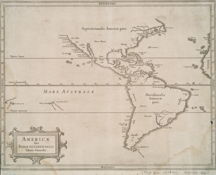
Americae sive Indiae occidentalis tabula generalis. ([1630?])
Image Title: Americae sive Indiae occidentalis tabula generalis.
Additional Name(s) : Laet, Joannes de, 1593-1649 -- Author
Gerritsz., Hessel, 1581?-1632 -- Engraver
Published Date: [1630?]
Item Physical Description: 1 map ; 26 x 34 cm.
Notes: National Endowment for the Humanities Grant for Access to Early Maps of the Middle Atlantic Seaboard. Note 2.) From Laet's Beschrijvinghe van West-Indien. Note 3.) Map engraved by Hessel Gerritsz--Burden.
Standard Reference: Burden, P.D. Mapping of North America, 229
Source: Maps of North and South America / Whole
Location: Stephen A. Schwarzman Building / The Lionel Pincus and Princess Firyal Map Division
Catalog Call Number: Map Div. 02-330 [Filed with America, [162-?], as originally cataloged in NYPL Dictionary Catalog of the Map Division]
Digital ID: 464990
Record ID: 292105
Digital Item Published: 2-3-2004; updated 3-25-2011
The New York Publica Library

No hay comentarios:
Publicar un comentario